
 The Early History of Nodaway County
Compiled from Heritage Collection resources May 1995
Nodaway County was established on February 14, 1845. It was one of six counties formed from the Platte Purchase of 1836.
Prior to these dates, the area had already been noticed by “civilization” and very early westward migration. The river named Nodaway, from Indian words meaning either snake-like or placid, appears on maps from the Lewis and Clark Expedition after the Louisiana Purchase of 1803. John Jacob Astor, when attempting to establish his Northwest Fur Company, sponsored a party led by Wilson P. Hunt in 1810-11 that explored the area, camping for four months at the mouth of the Nodaway River because of the abundance of game found there. They feasted sumptuously upon deer, elk and turkeys all through the cold winter. Other early references come from Sullivan’s line, Field’s Trace, Long’s Track and Gray’s Trace. Sullivan’s line marked the Iowa-Missouri boundary in 1816; Field and Long in 1819-20, give a description of the Nodaway County area as their paths crossed the terrain; and finally, Captain JS Gray in 1823 specifically mentions the 102 Mile Creek in his report. In 1835, the Mormons used a military road on the western side of what is now Nodaway County, through the Quitman and Burlington Jct. areas, to head toward Council Bluffs.
First settlement attempts
Even though it was set aside as exclusively Native American land, as many as 200-300 white families tried to move into the area in 1834-35. The militia was sent to remove these people, but some may have managed to stay. When the Platte Purchase was added to the state of Missouri, provisions were made to move Native Americans to Kansas. After that it was acceptable for settlers to enter. Two of the earliest groups known to explore the area were the Hogan, Taylor and Stewart party in the spring of 1839, and the Wade Davis group in the fall of the same year. Isaac Hogan, from Tennessee, became the first settler. Stewart later became Governor of Missouri. The Davis group went as far north as the three forks of the Nodaway, into Iowa, then returned to Platte County. Both groups were exploring, hunting and looking for bee trees. Isaac Hogan stayed to plant corn. By 1840 there were six known settlers in the area that was to become Nodaway County.
Early government
In 1841, Andrew and Holt Counties were organized. Holt County was initially called Nodaway, but the General Assembly a few days later changed the name to Holt in honor of David R. Holt, a prominent representative from western Missouri. So Nodaway County was not established until four years later when Atchison and Nodaway Counties were organized on February 14, 1845.
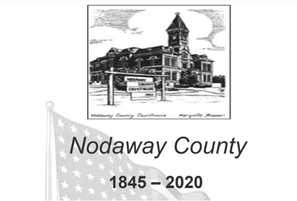
Three county commissioners were appointed: Amos Graham and William Sitton of Andrew County and Daniel Hunsucker of Holt County. Their duty was to select the seat of justice the first Monday of June 1845. They met at the home of Col. Isaac Newton Prather who had arrived in the county in 1839 from Kentucky with his horses to work the farm and to race. Amos Graham had become a county resident by this time and had been appointed clerk. He could no longer hold the position of commissioner, so he was replaced by Stephen Jones. Sitton, Hunsucker and Jones then purposely selected a central location for the county seat. In July 1845, the name Maryville was assigned to the site in honor of Mary Graham, Amos’ wife.
A few more people were moving into the area, but by the end of 1841 there were still fewer than 200 residents. Small settlements were forming such as Whitton’s Grove, Hutson’s Colony, White Oak Grove, Cock’s Mill, Shell’s Grove, White Cloud and others. Some of these locations were drop-off points for mail. The circuit rider had come through by 1843, stopping to preach to gatherings in private homes.
Townships, county lines
In 1845, the court began defining the townships Atchison, Buchanan, Hughes, White Cloud and Washington. After these were Polk, Dallas, Benton, and Jackson. Finally, by 1880, 15 townships had been designated. Additional names were Grant, Jefferson, Lincoln, Monroe, Nodaway, Hopkins, Union, Independence and Green.
In 1848, the Iowa-Missouri boundary was in dispute. Some thought the Missouri line was about 10 to 12 miles north of the present border. The US Supreme Court decided in 1849 to recognize the Sullivan line of 1816. That put the Nodaway County Townships of Benton/Buchanan and Dallas in Iowa and so, were deleted. The boundary was to be marked by stone or cast iron pillars every 10 miles and by a four foot, six-inch tall cast iron pillar with a 12 inch base at the old Northwest corner of Missouri. This old Northwest Corner was the northeast corner of Nodaway County. The pillar was erected in 1851 and still stands, although it is in Worth County, established in 1861. With the creation of Worth County, Nodaway’s eastern line was moved west and a narrow strip of land was assigned to Worth County. This pillar was in that area. It has a land area of 560,000 acres presently.
More people moved in. The Reading Colony, after much difficulty, obtained land in Jefferson Township. Settlers were coming from other states to join family and friends to form communities such as the Ohio Settlement in Nodaway Township. The population of the county in 1850 was just over 2,000 and by 1860 was more than 5,000.
Post-Civil War
As the Civil War broke out, things came to a standstill as citizens took sides. Over 80 soldiers from Nodaway County died in the war and many southern sympathizers left or were forced to leave, never to return. In 1865, two very important results of the war’s end were immediate. First, the freed slaves left the farms, coming to Maryville to establish a separate community within the town. Next, a large migration of ex-soldiers came from eastern states, bringing their bounty money and talents. The Drake Republicans were in control after the war and quickly established voting rights for the ex-slaves and a school in Maryville for black children, much to the chagrin of the southerners who still faced charges of treason in the Nodaway courts. Soon, a more moderate political climate evolved in Maryville and neighbors, except at election time.
Railroads and beyond
After the Civil War, railroads began advancing. By 1869, the Missouri Valley Company had built a line to Maryville. The Kansas City, St. Joseph and Council Bluffs Railroad extended it through Hopkins to the Iowa state line by 1870. In 1879 the Wabash, St. Louis and Pacific Railroad built a line through Nodaway County which came from Omaha. It entered the county at the northwest corner and ran diagonally to the lower eastern county line. In 1887, the Chicago Great Western Railroad established a line in the eastern part of the county. Small towns were organized about every five miles along these railroads. These included Elmo, Burlington Jct., Wilcox, Barnard, Guilford, Pickering, Hopkins, Parnell, Ravenwood, Clyde and Conception Jct. Branch lines were established through Clearmont, Burlington Jct., Quitman and Skidmore. Some early towns faded away when the railroad was not built through them, such as Lamar Station, Xenia, Prairie Park, Sweet Home and Bridgewater.
The impact of the railroads even on population alone is marked. From 5,000+ in 1860 to nearly 15,000 in 1870, then to almost 30,000 by 1880 indicates a major change in the life and times of Nodaway County, Missouri.
The peak of population in Nodaway County was at the turn of the century. The 1900 census was 32,938. It has gradually decreased by 1,000-1,500 every 10 years and was about 22,400 in 2017.
Businesses, industry
Other changes and advancements in Nodaway County include businesses and factories. In earlier years, there were local shirt and canning factories. Now, companies produce items that are sold nationally and internationally. The Old Savannah Road become US Highway 71,extending from Canada to the Gulf and was paved through the county by the 1930s. Rural free mail delivery was established in the county by 1901. A Normal School was begun in 1905. Local promoters had been working toward this since the 1870s, it is now Northwest Missouri State University, a land grant state university. A rural electric cooperative was established but work was not completed until after World War II. Rivers were straightened. County roads were built and improved.


Facebook Comments